Slieveanorra, Glendun River and rain lots and lots of rain

This Sunday, Mr Andrew Clark and myself set ourselves the task of sumitting Slieveanorra, navigating the valley of the Glendunn river and various bits and bobs of the Antrim Hills.

The weather in start contrast to last week was abysmal, misty cloudy and wet .. very wet but this is Norn Iron so am I surprised ? … No not really 🙂

The Route

The starting point is on the scenic route signposted from Magherhoney to Cushendun, on the Altarichard Road, if travelling from Magherhoney pass the picnic site on your left and another 1.5 miles later you will come  with a forest road on the right and a few yards later a forest road to the left and a small stone bridge a few yards further on. There is a small space that will allow you to park without blocking the forest road on the right.

Park up and get your self sorted then start up the forest road and follow it all the way up to the top of Slieveanorra  with it’s two ugly (but essential) masts. On a good day you can see a good 100 miles in each direction … today we were in the clouds so could barely see a foot in front of us.

Go past the masts and at the first bend in the track there is a Moyle Way waypost pointing to the right, follow this and you will come to the top of a wide twin furrowed path. Follow this path all the down into the valley, it is brave and soggy going at times. Then through the forrest until you come to a track running left to right. There is a path directly infront of you, ignore it and turn left and walk half a mile up the track until you see another Moyle Way waypost pointing to the right, follow this track down through the forrest to the road. Turn left walk about 800 yards up the road until the forest on the right ends and you see the small river flow down through the valley.

Walk down and cross the river and follow it’s course down the valley, it is quite stunning and a bit midgey, so an application of your preferred “jungle juice” is probably a good idea there were also a fair few “Cleggs” and “Ticks” in evidence so arces of bare skin are not a good idea either. About half way down you will come across a ruined farmhouse and beside the river are loads of what appear to be “Lazy beds” a sure sign this now relatively remote area was once the site of more organised cultivation. Further down on the other bank is an old lime kiln, which is rather out of context for the glen but kinda makes sense when you think of the acid bog water running in the river and the peaty nature of the soil.

Eventually you will come to a road which runs over the river, climb up to the bridge and turn left and follow the road up for 100m and you will find the much nicer Bryvore bridge which is a lovely place to stop for a coffee and a sarnie, if it isnt raining.

We had planned to continue on up into the Slieveanorra forest at this point but as it was lashing down we took the cowards way out and scampered the 2 miles up the road to the car and called it a day.  .. Total distance 7.5 miles which is under my “10 miles on a Sunday” target but it was very very wet 🙂

So where to next week?

Here are some piccies of the walk you can find the rest here

The Summit

The Summit

The Glendunn River

The Glendunn River

The Glendunn River

The Glendunn River


Posted in Walkies | Leave a comment

Conquering the Grey Man’s Path – A mega sunday dander!

First let me say OOOO My legs hurt something awful!

Gentle reader I hear you ask, “Why? Why? Why should this be so?” Well tis simple, myself and a colleague from work Mr Andrew Clark along with Ciara (C-MC) and Chuck (Chuck) from Wild-Ni who were silly enough to join me on another Sunday outing on the north coast, except this outing would include the conquering of “The Grey Man’s Path” which I mentioned here on a dander 3 weeks ago.

The Route

The Start

The Start (Photo by Chuck)

It has to be said it was a cracker day for a dander, sunny with a pleasant but not to strong breeze and it twas with smiles a plenty we set off from the car park at Marconi’s cottage @10:00 along the

Meadow

Meadow (photo by Chuck)

shore and up onto the cliffs of Fair Head using the farm track rather than scramble up the waterfall as the path here is seriously overgrown and very nettley!

At the top of the cliff we were greated by a meadow of short grass and wild flowers and with the sun and the view of Rathlin to our left we plodded on up and along the cliff edge towards Murlough


We made good time and arrived at the head of the Grey Man’s around midday for a spot of lunch and a sit down.

We then headed off over the cliffs past the last lake (“lough Fanna) and then up some more to the top of the cliffs about and to the east of Murlough.

The path down to Benvan cottage

The path down to Benvan cottage

At the top of these cliffs you pick up a path that takes you slowly down to Benvan cottage and then through the wood down to sea level, were you pick up the track leading west to the car park. Another stop here for a sit down and some more coffee and chocolate. Then off again taking the lower shore path westerwards to imposing cliffs of fair head and the boulder path. This path “ends” at two small tunnels, the last remnants of the Murlough Mines. This was sort of the point of no return – to continue westward meant entering the boulder field for a mile to get to the bottom of the Grey Man’s Path, the other option would be to take the upper path from the mines back to the murlough road and slog up the hill to the top car park. We decided given that it was dry and we were all reasonably fit, well attired and in possession of phone that had a decent signal that we would give the boulders a go!

Please please please, NEVER do this in the wet, NEVER do it in mist, NEVER do this on your own and NEVER do this without poles and big boots! Our previously brisk pace dropped from 3mph to a crawl. It took us nearly an hour to get from the mines to the bottom of the Grey Man’s path chimney!!! The going is slow, but if you do not rush it is not too difficult. From the mines there is the start of path that leads upwards, follow it and when it peters out in the boulders, keep heading slightly up and westward.

Picking our way through the boulders just before the lower Cliffs Section

Picking our way through the boulders just before the lower Cliffs Section

You will come to a lower cliff face where you can go up and hug the main Fair Head cliffs or skirt around the lower cliffs. We took the lower option and soon picked up a path (of sorts) which after much scrambling, rests and “OH F**K it is a long way down” comments we reached the end of the lower cliffs and a path of grass and wild garlic, the chimney of the Grey Man’s path is just above you… (Kudos to Andy Clark for taking “point” on this section he did a grand job to keeping us on a decent path).


Up the Grey Man's Chimney

Up the Grey Man's Chimney

We stopped there to get our breath and then it is a 20 minute crawl (yes I mean on your hand and knees) up the chimney to the top of the cliff. Again Andy lead the way and was it has to be said he was like a rat up a drainpipe! Only later did we discover he was doing his very very very best NOT to look down. Lotus Geeks please notice the rucksack!!


Done it!!

Done it!!

When we reached the top of the cliffs there was much sitting down done but we were all in agreement it was a hell of a buzz and something that “needed” to be done 🙂 from there we followed the path back down to marconi’s and basically collapsed in the car and headed back to Ballycastle and from there home.


Summary

Summary

Here is a summary of the dander
Data from Chuck (Thanks!) It took us 5hrs 21 mins of walking time with 1 hour 10  mins of pauses. Which for me was pretty good but perhaps a tad slow for Ciara and Chuck.


I have to say I am totally punctured this evening, so I am going to stop this post now by saying thanks to Andy, Ciara and Chuck who it has to be said are excellent walking companions and brave brave souls for trusting me to get them around what was an excellent if very Vertical dander on a glorious Sunday.. Chaps and Chapess I salute you! 🙂

Now where to next week?
My Facebook album of photos

Andy’s Facebook Album of Photos

Chuck’s Flickr Stream + videos

** Update ** Ciara’s Piccies


Posted in Walkies | 1 Comment

What have we done to our children?

Yes I am a tad tiddly … ok I am drunk …but only slightly … I have been out with some chaps from work for a relaxing evening of Saporamen, Guinness and Talisker and I feel the urge to rant so rant I will!! .Be warned I am straying to the land of religion and politics so if either are something you hold great stake in … it is probably better if you stop reading now.

Every year at or around the annual 12th July Protestant Wank Spasm I am reminded of this song and I encourage you from where ever you are from to listen to it, it tells an important message. The song which was written nearly 20 years ago at the height of “the troubles” has one telling line that resonates for me …

“Up here we sacrifice our children for the worn out dreams of yesterday”

and today that was brought home in crystal clarity as I left Marks & Spenser and there was an event in progress part of what is called “The 12th Festival” or “Orangefest” which is meant to make the annual celebration of Orangism more palatable to  the general public. An attempt to sugar coat the unacceptable for the masses.

I was met with an orange band seated near the town hall with 100 or so people watching who were playing this song. This song has the edifying lines ” We are up to our knees in Fenian blood SURRENDER or your DIE” in the chorus. “Fenian” being a local word Irish word for “Catholic”. Oh such a wonderful  idea to reinforce in the minds of the locals, such a wonderful ethic to pass on to the tourists present! Now please remember this was a local council supported event, so I paid for this in my Taxes, I have given tacite support for this band and the hate it advertised on a summer’ afternoon in my town center! To make the scene 1,000 times worse in the crowd were two grandmothers gleefully teaching their 5 year old grandchildren the lyrics ensuring they used the required gusto at the “BLOOD” and “DIE” sections.

I make no apologies but if the nature of your hate filled deity by which you set such store requires such hate -he is not for me! If there is a god and he requires me to be knee deep in anyones blood he can  FUCK OFF BACK TO THE ROCK HE WAS SPAWNED UNDER
regardless of the eternity I will spend in hell for such a sentiment.

Never ever will by I knee deep in the blood of those I disagree with – NEVER !!

Never will I teach a child of mine that such behaviour is acceptable EVER!

I mourn for the innocence of my countries children for we are savages.

Posted in Blogging | 1 Comment

Up the Glen of the Plough (Glenarriff County Antrim)

Today I took myself off to one of the jewels in County Antrim. Glenarrif or the “Glen of the Plough” on the Antrim Coast.  Glenarriff was formed by a big glacier in the last ice age and it cut a deep valley in the hills of the Antrim plateau which has been habitated since the trees grew back.

Glenarriff Castle

Glenariff or the “Queen of the Glens” cascades down from the Antrim Plateau is the largest and the most famous of the nine glens, it is a perfect u-shaped valley with  beautiful views and spectacular waterfalls and at its mouth lies a one mile sandy beach where the glen meets

the sea at the small village of Waterfoot.

Around 100 years ago, lots of trees were planted to enhance the native woodlands of hazel, oak, ash and willow and to make the area more attractive to its many visitors. The glen is bounded by rugged precipicies 200 to 400 metres in height, the two most famous being Carneil and Lurigedan, but that was not our target for the day, Trostan the highest point in county Antrim some 1880 feet above the car park were we started the walk.

When I say we, i have to add a new dandering buddy Chuck from “Wild NI” joined me for my perambulations around the Glen. Excellcent company he was and an understanding soul who did not scamper (as he could have) up the “uppy” bits but matched his pace to my more sedate grump old fart pace.

We met up at 10am in Glenarriff village , down at sea level and picking up the Ulster Way we followed the Glenarriff river up the flat floor of the valley.

The Path starts about 100 yards down from “The Mariner” pub at a gate beside a car park in a council estate.

You can also find decent parking down the main street in the left beside the beach

Anyhow onward we walked down a very pleasant and very very gradually rising path

beside the river (had a bit of chat to an angler we met who has of course just “Lost a monster!), After about 2.5 miles the path leads you up to to the Glen Road which after another mile or so, leads you into the glen itself.. and you are met by this rather wonderful sign.

Swans have a heavy myth resonance around the north coast because of the story of the Children of Lir. (Synopsis, evil step mother turns step children into swans and curses them to stay swans

Oh YES PLEASE!!!

until the “Bell of the new god is heard in Ireland” the swans few around ireland before ending up in the straits of Moyle and were saved by a Christian Priest ringing his bell)

Ess-na-Larach

Ess-na-Larach

From this point we enter the Glen proper which is famed for its waterfalls the biggest of these is Ess-na-Larach. If waterfalls are your thing, Glenarriff has both lots of water and lots of waterfalls. There are several paths you can follow through the glen , the longest circular path is around 9km , but be warned it is very steep in places and prone to be a bit muddy.

Once you come out of the Glen itself you reach a car park and cafe, a good and very friendly place to have a stop, a drink and a spot of lunch and the view from the picnic tables …. well it is hard to find a better one in Northern Ireland!

The View fron the cafe at the head of the glen

From there, follow the road out of the glen and opposite the entrance you will see a sign post of the Ulster/Moyle Way. Cross the gate and follow the path up and up some more through the forest until you meet another road, Cross this and on the right about 20m up you will see a style and a path leading up towards Trostan’s summit.

It was at this point Chuck and I met some people coming down who let us know that Trostan was always damp and today damper than most, so we decided not to do the last 100m of ascent and we headed back in a long arc down through the forest, back to the cafe and took the long loop back to the floor of the glen down a different set of paths, all well signposted and way marked.

Once back to the Glen floor we picked up the path by the river and arrived back a The Mariner for a pint and a bit of a sit down. All in all an excellent 17 mile walk!, We only got rained on a little and Chuck was excellent company and a joy to walk with – Thank you!

Now where to next week?

PS here is a link to the FB Gallery which as all the other waterfalls on it

Posted in Walkies | Leave a comment

The Passing of The King of Mountsandel

I know it is wrong to anthropomorphize animals, but it is very hard not to see human characteristics in the beasties that prowl, flutter or slither over this blue marble we call home.

This is the story of just one of them and I make no apologies for calling him “The King of Mountsandel”.

For the past 2 years I have been  walking to work and my route takes me down the Mountsandel Road, one of the main arterial roads into Coleraine and the site of the old Coleraine Hospital. The old hospital complex has been demolished these past 10 years and more and the only building left standing is what used to be the oldest part of the hospital and as a result of it’s age it is a “listed” building and has to be preserved. The rest of the site is a mixture of rubble and green spaces slowly being taken over by small trees and shrubs.

Every morning on the way by there would be 5 or 6 feral cats mooching around mostly ordinary unremarkable felines apart from “The King” who like GrowlTiger in TS Elliot’s poem had one ear, one eye and a broken tail and a patchwork of scars to rival any prizefighter. The King’s favourite spot was to sit on the step of the admin building and survey his domain. The other cats would sit in such a way that they never caught his eye and ensured they stayed well out of the way. Contrary to the evidence of his scars he appeared to be a relatively benign ruler, when kittens appeared on the scene every few months he didn’t seem to mind the occasional small ball of fluff making a pest of itself.

I would get a 3 minute window into the world of the Hospital Cats every morning as I walked past and I found myself disappointed if The King was not there to ignore me when I wandered past on route to my desk.

This morning as I looked through the fence, The King was on a window ledge and I paused , why I paused I have no idea but pause I did. The King jumped down onto the cracked tarmac and it was obvious that all was not well. His usual regal demeanour was gone, he looked like every year of his life and every fight that he had picked had happened in the last 24 hours.

He made his way out of the shadow of the building and found himself a place in the sun between a purple patch of flowering Rosebay-Willow Herb and the ash tree the cats used as a scratching post. He lowered himself down onto his front legs and very gingerly his rear end followed suit. He raised his head, closed his eyes and for a second savoured the sun’s warmth, then his head fell and like a discarded rag doll he rolled onto his side and lay still.

It took me a minute to find a way through the wire fence and by the time I got there it was obvious The King was no more. I know that death is part of life and everything dies and in the wild it just happens and the world moves on.  However it seemed wrong to just leave him there for the scavengers so I lifted his body and placed it behind the scratching tree, covered him with a piece of sacking and made a small pyre of stones to cover his cooling corpse.

If cats have a heaven I hope he made it in and now has all the comforts life didn’t seem to afford him in great measure.

The King is dead, long live the king!

Posted in Steve, Thoughts | 2 Comments

A new/old Sunday Dander for me – Fair Head Ballycastle

Having dandered mainly inland this year, I decided for this dandering Sunday to walk a walk that I have actually done before but over 30 years ago and I though it was time I revisited it to see (a) if it was still awesome and (b) could I still do it.

Ballycastle is basically right up in the top of Norn Iron to the right of the Giant’s Causeway

Ballycastle

Ballycastle

and as you can see has Rathlin Island a couple of miles off shore. Rathlin is a strange island famed for the story of Robert the Bruce and the spider where Bobbie having had his bottom spanked by the English at the battle of Perth in silly long ago time may (or may not) have hid in the Uaigh na gColman (Cave of the Pigeon) on Rathlin and saw a spider having problems spinning a web the spider kept trying and encouraged Bobbie the Bruce to “try try and try again”

Rathlin aside, as it is a trip for another weekend, Ballycastle is backed by the lowering lump that in Knocklayde another fine and thigh bursting dander.

Knocklayde

Knocklayde

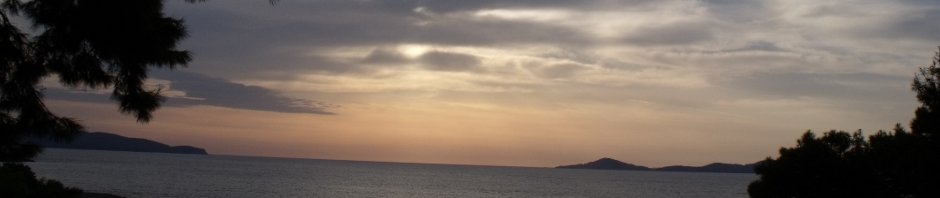
and flanked by the imposing sea cliffs of Fair Head and it is Fair Head I am headed for today, from the car park in Ballycastle Harbour over land to Fair Head, down in to Murlough bay and then back by road to the car

Fair Head Cliffs

Fair Head Cliffs

Now I have to add at this point this is NOT a Sunday afternoon wander in the country! You should not attempt this walk if you are less than reasonably fit, not scared of heights and equipped with stout waterproof boots, waterproofs and a decent walking stick. The going in the off road bits is always wet, sticky and in some places very very very vertical!

Also be aware that you are crossing farm property at the top of the cliffs so do not leave gates open, watch out for livestock and most importantly do not drop litter like fecking confetti at some deranged wedding. (I hate this hate hate hate it)
The route is relatively simple, park your car on the Promenade or Harbour Car Park in Ballycastle and head towards the beach, cross the River Margy on the foot bridge and walk the full length of the beach. When you get to then end take notice of Pan’s Rocks and for those eagle eyed enough walk half way out over the bridge and look at the rocks on the other side of the pool and you may be able to pick out a face carved in the rock

Pan's Rock Face

Pan's Rock Face

The face it that of a man that a lady was forbidden from  marrying or seeing ever again by her sisters. So if she could not marry the man she wanted he vowed never to marry anyone. She went out to the rock every day for weeks to carve the face of her lover, returning each evening with bleeding hands

One day when working in the fields she had a fit and gave birth to baby girl and nearly bled to death in the field. Her lover the man who she could never see again picked her up and took her to the Doctor in Ballycastle. Overcome with sadness at the thought of never being able to see his love and his newborn daughter, he threw himself into the sea and drowned.

The woman and her daughter survived and she would go out to the carving and weep for her lost love, and her wails were heard above the lashings of the sea even in winter.

That’s the story or it could just be some ancient graffiti … who knows?

Corrymeela

Corrymeela

Where was I .. oh yes.. the route, come off the beach and up onto the road and keep on until you reach a junction that points up the hill to Corrymeela ,a place worthy of a library of posts all to itself. Corrymeela in Irish means “Hill of Harmony” and at the top of the road is a centre for reconciliation bearing the same name as the hill. You can find out more here. It was a place I spent many many summers with the rest of Clan McDonagh and I have many many pleasant memories.

North Star Mine

North Star Mine

Ignore the turn and keeping the sea to your right keep on the road towards Fair Head
You will pass the entrance to the North Star Mine, a small tunnel on the right and to the left you will see a natural rock formation that points to the north star, called the north star Dyke. Ballycastle used to have coal mines and this is one of them. The coal was low quality shale coal and the mines closed when better coal was found in Northern England and Scotland.

The road ends at a small cottage now largely rebuilt as a private dwelling. This cottage is known locally as Marconi’s cottage for twas there than the gentleman of the same name is meant to have played around with the first Wireless transmissions over water. This may or may not be true, but the name has stuck and Marconi’s cottage it remains.

Take the path to the right of the drive to the cottage and start the path.

The Path

The Path

This path is NOT big, it is always wet and bits of it have some pretty vertical drops into the sea so BE CAREFUL and take your time! Pick your way through bracken, boulders and some of the most stunning scenery on the North Coast, with Rathlin to your left, the cliffs of Fair head to the right, the causeway coast behind you and Scotland only 14 miles away in front of you.

The Waterfall

The Waterfall

Keep following the path until you come to a waterfall, cross the stream below the style and head for a tractor path to your right. You can try going up a path beside the waterfall but this is VERY slippery so use caution.

Follow the path up, up up and up some more until you reach a 6 bar gate. You will notice a path leads on to the east. Beware this leads you into the Boulder Field at the base of the cliffs and this way maddness lies. It is possible to navigate the boulder field, but great care is needed

The Path to the Boulder Field

The Path to the Boulder Field

as it is slippery and there are some very deep cravasses. If you do attempt to cross it take a sharpknife and watch “127 hours” before you do. Also tell someone you are doing it and take some form of communication with you. Basically I would caution you not to bother as it takes HOURS to get any distance, is very tiring and very very very dangerous!

Climb over the gate and keep following the path until you get to the top of the cliffs. You will notice a wall running up to your left, leave the path and follow this wall keeping the cliffs to your left and you will soon find the cliff path. Remember you are on farmer’s land now.. Keep to the country code!!

Lough Dhu

Lough Dhu

Follow the path and you first come to Lough Dhu (Black lough) which has a run off over the cliff, follow the edge of the lough around (Quite boggy) and cross just at the edge of the cliff.

Grey Man's Path

Grey Man's Path

Keep on the path for another 1.5 km and you will come to the Gray Man’s Path, a Very steep crack in the cliff with a bridge made by a fallen slab. There is a path down thru the cleft but is it very slippery and takes you down into the hell that is the boulder field. But if it is dry and you are feeling energetic it clambering down does afford you some beautiful views. Today was way way to wet, so I admired the view down and had a cup of coffee and some Tayto Pickled Onion Crisps and a mars bar instead 😉

Keep following the path along the cliff edge all the while remembering that there is a 200m drop just to your left! To your right you will have lovely views of Lough Crannagh which has in the middle a Crannog.

The Crannog

The Crannog


This is a late bronze age man made island and was the precursor of the modern “Panic Room” if you were being attached you vamoosed over to the crannog with your family and prize possesions and waited till the danger passed.


Keep on going and you will eventually come to a view of Murlough Bay below you and a track that leads in land, so you have a choice .. you can

Murlough in the Rain

Murlough in the Rain

continue on the cliff path that will eventually lead you down to Murlough Bay Road or you can follow the track back along the shores of Lough Crannagh. Since it was Pishing down mightly I took the track back towards civilisation but did get as far as a decent view of Murlough Bay.

Follow the track back and you will come to a farm walk through the farm yard and you will pick up a metalled road which you just follow back to Ballycastle. There is a pub about 2 miles down the road which has a nice seat or two to sit at and watch the world go by as you sip a pint or in my case a cup of coffee and a mars bar.

Ballycastle is 2 miles down the road from Hunters Bar but before you rush in there is a little oddity on the left hand side of the road about half a mile from Ballycastle. There is a ruined Friary called Bonamargy which is well worth a 5 minute detour. In the grave yaard

Bonamargy Friary

Bonamargy Friary

there is a section for the bodies of sailors washed up on the shore (The north channel is one of the most difficult stretches of water in the UK and sadly there are a lot of wrecks) You will find grave stones for WW1 and WW2 and if you search hard enough there are some really old ones that date back to the Spanish Armada which ended up wrecked around the north coast of Ireland in a momentous storm.

In the main section of the friary you will come across a strange circular stone with a hole in it. This grave marks the final resting place of Julie McQuillan a 17th Century prophet and recluse. She as known as ‘The Black Nun’ and oddly she wished to be buried vertically (Standing rather than lying down) at the entrance of the chapel so that she might be trodden on by the the feet of the faithful … go figure. Her ghost it is said still walks the grounds and as some of my chums will testify I have actually been said ghost on many occasions, but that is a tale for another day. Unless John Oehrlein or John Donaldson want to contribute their memories on the comments thread. 😉

Another 5 minutes dandering and you are back in Ballycastle …. 13 miles later.

If anyone reading this fancies doing this or any other of the walks I blog about please drop me an email and I will arrange something for you and you can see all my pictures from today here on my Facebook Piccies page.


Posted in Steve, Walkies | 5 Comments

My Dad and are there fish under that bridge?

Time ,it is said, is too precious to waste and too precious not to share, life is good so share it.

I am not good with time. Henry Thoreau once quipped “Time is a stream I go a-fishing in” and that is what I do, much to the annoyance of the wonderful Val, this blogs co-author. I fish in Time, I catch the bits I want and store them in the keep net of my head and most of the rest is .. just stuff that happens. I don’t keep track of dates, I rely on others for prompts that wedding anniversaries and birthdays are due and in that reliance I miss things that perhaps I should not.

This came to light today when I was sitting with my long suffering Mother, (long suffering because she is MY mother) and it came to light that with travelling and other what nots and flim flam I missed the anniversary of my Dad dying.

There are many days  when I wish he was here and  I feel his absence deeply. To meet and captivate, as he always did with my girl friends, Val. To make a speech when I got married.  To do the proud grandfather thing when Niall arrived pink and loud into the family. All moments missed and filled with that unrequited potential of “what iff-ery”.

But .. my dad did not stop being my dad when he died. He did not stop being there for me in those moments that a hug was needed or a calming word required. He is and always will be that little part of me that is quiet and thoughtful, (yes it does exist), the part that is quick to laugh, the part that never allows a question to go unasked, the part that never wants to leave an injustice unchallenged, the part of me that understands that happiness is not having what you want but wanting what you have, the part that helps me be a father to Niall and the part of me that cannot cross a bridge without wondering if there are fish under there.

This is the “me” that he planted and watered all those years ago and I continue to grow in ways that might surprise him but for which I will forever be thankful. These things need no special day to remember. These things are and will always be “my dad” not echoes nor frail memories but real palable things I rely on every day.

Maybe that’s what it’s all about after all …

So a couple of days late, I raise a tin of Magner’s Pear Cider late in the evening and make a toast to my self and the universe

“Dad …. Thanks!”

Posted in Steve, Thoughts | Leave a comment

3 Weekend Walks nothing startling but some beautiful “lost” places

This weekend I have a collection  of 3 walks, the first is the Errigal Train In Glenullin ( http://www.walkni.com/Walk.aspx?ID=144 ) which is a marvellous short 3 mile walk through a remnant of the ancient Irish deciduous woodland beside the River Agivey a little known and very well maintained gem in the North of Ireland and well worth a visit. The walk is easy and can be completed by even novice walkers.

The Second walk was thru Somerset Forest trail and Christie Park In Coleraine, a walk I can do from and to my front door.

The Third was a walk across Dumore hill from Largentea Car Park following the Curly Burn down to Bolea road, a bit of a detour down to Lady O’Cahan’s bridge, Sweathouse and Mass Stone. The Mass Stone is a place where during the Penal Laws when the Protestant Monarchs and Gov of Britain made the act of saying mass illegal. As a result the local catholic priest would sanctify a place usually with a large altar like rock where his congregation could celebrate mass in secret. It also has to be said that most local protestant landlords turned a blind eye to this practise. Ireland both north and south is peppered with “Mass Rocks” the mass rock from Bolea has been moved and is now in St Mary’s Chapel Limavady.

The town land of Largentea and the valleys in the high bog have been lived in since the stone age and it used to be a thriving community even within living menory, but now it is reduced to a few modern farms. In conversation with some of the locals it was pointed out to me that the track down to Lady O’Cahan’s bridge (Which is all but gone and overgrown) is surrounded my numerous low stone walls that were until the early 1900’s houses, fields and gardens of 20 or 30 families now long gone and overgrown with hawthorn and birch and beech trees.

The locals created a sweat house beside the curly burn, a low stone beehive structure lined with moss and peat. In the center of the sweathouse a fire would be built and you would sit inside and sweat, much like a sauna, once you had had enough you would go plunge in a pool in the Curly Burn (it’s about 6 foot deep even when the burn is low)

It is sort of sad that we have lost these communities and their old fashioned ways of doing things. It must have not been that much fun, but I would really quite like to have seen and experienced it first hand.

C’est la vie is suppose

Here is a picture from the walk, it is the shady glen where the mass rock once stood, now all that is left is a small stone circle and the rock on which the orginal stone cross sat. Even without the religious mumbo-jumbo you can see why they choose it.

Click on the image to go to the face book gallery and the rest of the pictures

Largentea Walk

Posted in Steve, Walkies | Leave a comment

A plea for some $$ and ££s for a friend dandering for dosh

In this connected “social” world of the internet that I and the ever patient and uber tidy Valerie (aka Slightlydoolally) inhabit on Twitter Facebook etc, there comes the occasional moment when the day to day stream of news, geek miscellanea and in my case downright weirdness takes a bit of a back seat and something important comes along and this is one of those occasions.

You may have noticed, I am a danderer, I love a bit of a plod around the countryside taking pictures and generally making a nuisance of myself by looking over fences and shouting MINT SAUCE at passing sheep so I take a keen interest in places my chums go for a dander. So it was with some excitment in Casa McDonagh that we noticed one of our  online chums Jules is doing the INCA TRAIL in Peru!! Setting aside for the moment that this is one of my “bucket list” danders and the jealousy quotient was immediately off the scale, Jules is doing this to raise some cash for a very important charity The Children’s charity.

The Children’s Society is committed to helping vulnerable and disadvantaged young people, including children in care and young runaways. They give a voice to disabled children, help young refugees to rebuild their lives and provide relief for young carers. Through their campaigns and research, they seek to influence policy and perceptions so that young people have a better chance in life.

TheSprog © (aka Niall McDonagh) can be a right royal pain in the arse, infuriatingly childish and yet thoughtfully adult in equal measures and his road to adulthood has been both fun and difficult for him and us his parents. BUT and this is an important “BUT” many many children do NOT have the fun bit in their lives, for them it is just difficulty heaped on difficulty that that is quite simply WRONG! That is why Val and I are right behind Jules in her effort to “Dander for Dosh” for this important cause.

Now I know times are tough for us all just now and demands on our purses are many, however if you motly collection of family, friends, colleagues and fellow geeks could spare just a couple of £s or $s today to help Jules raise and pass her target of £3950.00 for this very important charity, it would be the best couple of clicks you could use your mouse for  on this Easter Sunday. So Please please please please click here and give Jules as much as you can … one less pint this evening and you will be helping to bring smiles back into the lives of some kids and you can’t really say fairer than that!

Happy Easter to you all  – Steve and Val


Posted in Blogging | Leave a comment

The Ascent of Benbradagh

Sunday being “Dander Day” I was up and about at 8am having planned a new walk up a local mountain, part of the Sperrins range in County Londonerry about a 15 minutes drive from Casa McDonagh and not that far from “The Dunbane Dander” I did in Glenullin 2 weeks ago.

Benbradagh is one of the peaks that the “The Glenshane Pass”  a road that links Belfast and Derry passes through. Not  I do have to add at this point that when I say “Mountain” I am not referring to the Alpine variety. The Last Ice age sat thick on Ireland and as a result the mountains were all ground down leaving some stunning scenery  but not terribly high mountains. Benbradagh is around 1525 feet which some would say is a large hill and yes it is not that high, but it is surrounded by peat bog, which makes the walk somewhat more strenuous that you would expect.

My chum and fellow danderer Garrett Murphy from Portrush joined me on this 8 mile walk and it has to be said that he was very generous to this old codger and set a decent pace that pushed me but didn’t knacker me…. too much 😉

It was a fantastic walk one I will definitily do again!!

You can have a look at the piccies I took here. (will open a Facebook Album)

Carraghbane

Posted in Steve, Walkies | Leave a comment