First off I have to give credit to Julie Clarke, long suffering better half of Andy who danders will me on Sundays for the title of this post., both apt and more erudite that my more usual post titles. Thank you Julie!
This Sunday Andy and I set off for a plod around the high up bits of the Sperrins. The Mournes have the seven sevens (Seven summits all more than 700 metres) well the dander we did could well have been called the six fives for the same reason. Our target for the day was the summits of Bohillbreagha, Craig-na-shoke, Mullaghmore, White Mountain, Glenshane and Corrick. This essentially is the ridge line that forms the southern side of the Glenshane pass, the main road between Belfast and Derry through the Sperrins.
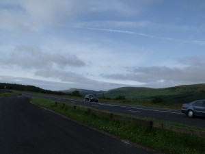
The Starting Point
The starting point is the first lay by on the right past “The Ponderosa bar” probably the highest bar in Ireland, definitely the highest in Northern Ireland but more of that later.
Cross the road and take great care this is a main road and drivers are inclined to go a tad quickly!! Turn left and about 200 yards down the road you will come to a turn that leads you down into Glenshane forest.
Enter the forest and at the first junction turn right and then immediately left and walk along the main forest road. This track follows the stream that will eventually become the River Roe and it gradually starts to climb and around 2 miles in turns away and gets steeper.
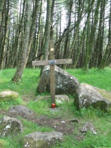
The Mass Rock
After a mile or so you come to the site of a “mass rock” in a glade in the trees. This is another of those places that dates back to the penal lawswhen celebrating mass was against the law, so Catholics worshipped at places like this. A local told us later that the congregations in Dungiven were still using this site once or twice a year as a place of pilgrimage until fairly recently. This was indicated by the Cross that marks the old altar stone, the collection of copper coins and rosaries left by visitors fairly recently.
If you stand with your back to the mass rock the route out is up the hill to the fallen trees then turn left and follow a raggedy path up and out of the forest. In a 100 feet or so you will come to the boundary fence where there is a style. which you cross and you are on the open side of Bohillbreagha. Head straight up almost south and you will come to the summit of the hill. One down!
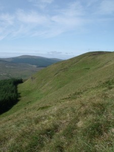
The ridge of Mullaghmore
From the summit turn take a bearing on the mast on Mullaghmore (around 283 Magnetic) and head towards it the next summit you get to is Craig-na-Shoke. Be careful there are cliffs to the left of the ridge, however the path is set a good 100 yards in from them. From Craig-na-Shoke head west, cross a fence at the gate you can see and then head up the grassy firm slopes of Mullaghmore and follow the path along the ridge to the summit. Again taking care of the slope and cliffs on your left that run down to Moydamlaght forest. Once you get to the mast at the top of Mullaghmore you get the most stupendous view (eather permitting) of Donegal, Derry, Antrim,Down, Lough Neagh, Tyrone, the Irish Sea and Scotland in the distance.
Follow the road down off the summit for a couple of yards and the bank on the left is a wonderful place to get out of the wind and have a spot of lunch. When you are down follow the road down through one gate and just before the second one you will see a gate made of a wooden pallet in the fence on your right. Go through this gate and follow the fence that runs up to the summit of White Mountain.
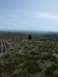
Andy after his stick breaking jump
Be careful! The path is rutted with deep channels in the peat cut by small streams over the years. Some of these are 6-7 feet deep and the peat on the bottom is very very soft and deep. As Andy discovered when he bravely jumped into one and sank up to his knees, falling backwards and breaking his walking pole neatly into two bits.
He took this loss of kit stoically and finding a only fence post used this as a replacement for the next couple of ascents.
Be careful there is an old fence line just inside the new and there are tangles of old metal post and wire that will snag the unwary foot.
Follow the fence up and over White Mountain and then down into the col between it and Glenshane mountain. The going is quite tough as the path disappears into old growth heather and some very sucky peat bogs. It was around this point that Andy and I decided to pitch for a new BBC series called “The Bog Faeries”, but more of that later perhaps, depends on if the BBC commissioning editor bites at my suggestion.
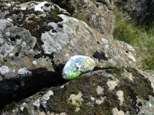
The Stones New Home
At the end of the climb up to Glenshane mountain I left my “Mountain Stone” just to the right of the fence. Some people plant flags on mountains they climb, some build cairns … me I leave varnished stones.
If you ever find a stone like this on some mountain or coastal path, if you like it please take it home if you have the urge, I don’t expect to see them again 😉
Keep following the fence on to the last summit of the day on Corick mountain the follow it down slowly until you come to a fence running down toward the forest where you started. turn and follow this fence down until you come to a small gorge, cross at the head of the waterfall, cross the fence at the gate (another pallet) and keep heading downwards until you come to a proper gate on the right, Cross this gate and follow the path back to the entrance to the forest and cross the road to the car park.
Walks statistics => Distance – 10 miles , Total ascent – 1175m , Walking time 5 hours.
You should NOT do this walk in mist or rain the path out of the forest is hard to follow in reduced visibility and there are unfenced cliffs and some seriously deep peat sheughs that would appear to suffer from flash floods!
The Ponderosa Bar is a marvelous place for an end of walk pint, the staff are helpful, friendly and chatty. The beer is gloriously cold and very very very welcome after 6 hours on the mountains.

 Steve's Email
 Steve's Twitter
 Comment RSS